The highest point in Pennsylvania is lower than the lowest point in Colorado!
Pennsylvania's Peak Can't Touch Colorado's Valley
Stand atop Mount Davis in Somerset County, Pennsylvania, and you've conquered the state's highest point. At 3,213 feet above sea level, you're literally on top of the Keystone State. But here's the kicker: you're still not as high as someone standing at Colorado's lowest point.
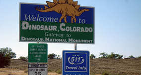
Where the Arikaree River trickles across the Kansas border in Yuma County, Colorado bottoms out at 3,317 feet above sea level. That's 104 feet higher than Pennsylvania's summit. Colorado's basement beats Pennsylvania's penthouse.
The Rocky Mountain Effect
Colorado doesn't mess around with elevation. The entire state sits on a tilted platform of high plains and mountains, giving it the highest average elevation in the country at 6,800 feet. Even its flattest, lowest corner in the northeast—where cattle outnumber people and the horizon stretches forever—still hovers well above a mile high.
This isn't just a Colorado-Pennsylvania oddity. Colorado's lowest point ranks higher than the highest point in 18 other states, including Delaware, Florida, Louisiana, and Rhode Island. You could stack those states' summits and still not reach Colorado's floor.
Pennsylvania's Modest Mountains
Pennsylvania's landscape tells a different geological story. The state's mountains are ancient, worn-down remnants of the Appalachian range that formed hundreds of millions of years ago. Mount Davis itself sits in the Allegheny Mountains, a relatively flat plateau that barely qualifies as mountainous by Western standards.
The summit features a 50-foot observation tower (because apparently 3,213 feet wasn't enough) and some nice picnic areas, but visitors expecting dramatic alpine vistas might feel underwhelmed. It's more "pleasant wooded hilltop" than "majestic peak."
What This Says About American Geography
- The Continental Divide matters: Everything west of it sits significantly higher than the East Coast states
- Erosion is relentless: Pennsylvania's ancient mountains have been ground down over eons while the younger Rockies still stand tall
- "Mountain state" is relative: What counts as a mountain in Pennsylvania would barely register as a hill in Colorado
Next time someone brags about climbing to Pennsylvania's highest point, you can offer this humbling perspective: they'd need to dig a 104-foot hole at Colorado's lowest spot just to match their elevation. Geography has a funny way of keeping us humble.
Frequently Asked Questions
What is the highest point in Pennsylvania?
What is the lowest point in Colorado?
How much higher is Colorado's lowest point than Pennsylvania's highest point?
How many states have high points lower than Colorado's lowest point?
Why is Colorado so much higher in elevation than Pennsylvania?
Verified Fact
This fact has been reviewed and verified against original sources.
Show verification details
Mount Davis (Pennsylvania's highest point) is 3,213 feet. The Arikaree River crossing (Colorado's lowest point) is 3,317 feet. Colorado's low point is 104 feet higher.