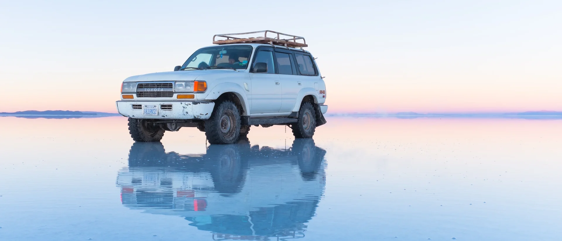
Bolivia's Salar de Uyuni is the world's largest mirror. Once a year, seasonal rain covers 10,582 square kilometres of salt so flat the horizon vanishes. You appear to walk on the sky. The surface varies less than a metre in elevation across the entire expanse. Space agencies calibrate their altimeters here - five times better than open ocean.
Bolivia's Salt Flat Is the World's Largest Mirror
Stand at the edge of Salar de Uyuni in Bolivia during the wet season and the ground beneath your feet becomes the sky. The horizon vanishes. The clouds are above you and below you at once.
The Flattest Place You Can Stand On
Salar de Uyuni sits on the Bolivian Altiplano at 3,656 metres above sea level and stretches across 10,582 square kilometres, making it the largest salt flat on Earth. It formed from the slow drying of a series of prehistoric lakes, leaving behind an eight-metre crust of salt. Across that entire expanse, the surface elevation varies by less than one metre. Few stretches of terrain anywhere on the planet are this flat.
The World's Largest Natural Mirror
Between December and April, seasonal rains deposit a thin layer of water across the salt crust. Because the ground is so perfectly level, the water does not pool or drain. It spreads in an unbroken sheet and, with no wind to disturb it, becomes a near-perfect reflective surface 129 kilometres across. The sky and the ground merge. Visitors appear to walk on clouds, stand inside sunsets, and be swallowed by the Milky Way. The clearest reflections typically appear in January and February, and the effect disappears as the dry season arrives and the water evaporates.
Five Times Better Than Open Ocean
The same qualities that create the mirror make Salar de Uyuni one of the most valuable calibration sites on Earth for space agencies. Its extraordinary flatness, high reflectivity, and stable dry-season conditions make it roughly five times more effective for calibrating satellite altimeters than open ocean. NASA's ICESat laser altimeter mission used it as a ground-truth reference, achieving elevation measurement accuracy below two centimetres. A kinematic GPS survey confirmed the surface's absolute accuracy to within 2.2 centimetres. European and American agencies continue to use it for this purpose.
What Lies Beneath
Below the salt crust lies one of the world's largest known deposits of lithium, a critical material for electric-vehicle batteries. Bolivia holds roughly 22 per cent of the world's identified lithium resources, and the majority sit under the Salar. The tension between large-scale extraction and preserving this landscape is an unresolved debate in Bolivia.
Frequently Asked Questions
Where is Salar de Uyuni located?
When does the mirror effect happen at Salar de Uyuni?
Why do satellites use Salar de Uyuni for calibration?
How large is Salar de Uyuni?
Does Salar de Uyuni have lithium?
Verified Fact
Verified Jun 24, 2026 · 5 sources checked
Source: Wikipedia - Salar de UyuniShow verification details
Claims checked
- Core claim (world's largest mirror, seasonal)
- Size 10,582 km2
- Flatness <1m elevation variation
- 5x better than open ocean
- Satellite altimeter calibration (NASA + ESA)
- Mirror season Dec-Apr, Jan-Feb clearest
- Seasonal/not permanent framing
- Equipotential surface / gravity field (engagement comment)
- GPS survey 2.2cm RMSE (engagement comment)
- Lithium 22% of world resources
- "European and American agencies"
- source_url Wikipedia supports all headline specifics
Related Topics
More from Places & Culture
View all Places & Culture →